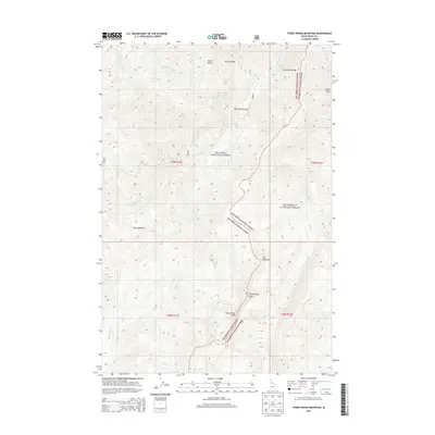
2013 Map of Three Prong Mountain
USGS Topo · Published 2013About this map
Nez Perce National Forest and Bitterroot National Forest meet in this high-elevation landscape within Idaho County. The topography is defined by sharp ridges and deep drainage systems, most notably Three Prong Mtn and its associated Three Prong Ridge. The convergence of these two national forests creates a complex boundary that follows the natural contours of the land, including the steep descent known as The Drop-off.
Find a feature on this map
26 named features on this map. Tap any name to fly to it.
Don’t see what you’re looking for? This feature index may not catch every label — zoom into the map to look around manually.
Map Details
Editions of this 2013 Three Prong Mountain Map
This is the sole edition of this map. No revisions or reprints were ever made.
Other maps of this area

1956 · Elk City
USGS Topo · 1:250,000

1960 · Elk City
USGS Topo · 1:250,000

1966 · Spot Mountain
USGS Topo · 1:24,000

1966 · Green Mtn.
USGS Topo · 1:24,000

1966 · Three Prong Mountain
USGS Topo · 1:24,000
1966 · Wylies Peak
USGS Topo · 1:24,000
1966 · Gardiner Peak
USGS Topo · 1:24,000
1966 · Running Lake
USGS Topo · 1:24,000

1978 · Spread Creek Point
USGS Topo · 1:24,000

1978 · Magruder Mtn
USGS Topo · 1:24,000