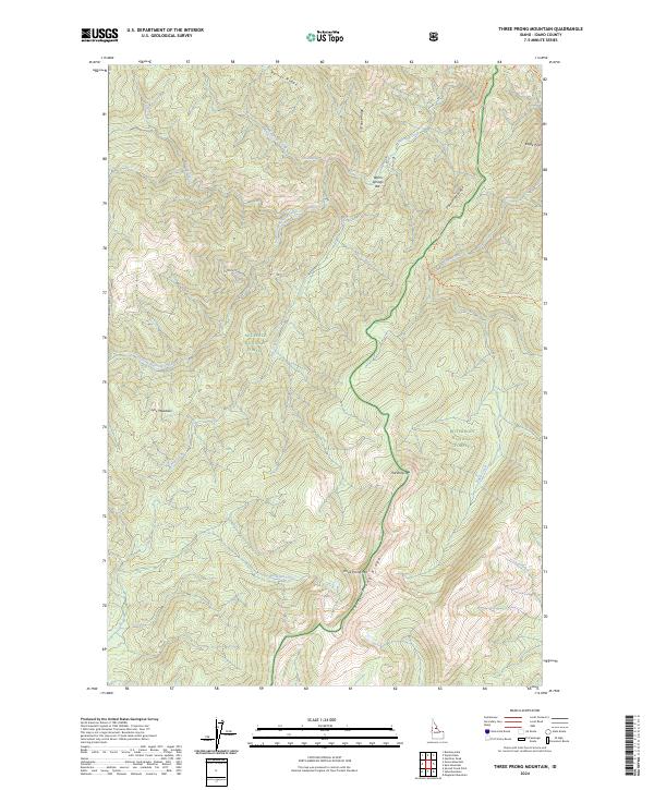
2024 Map of Three Prong Mountain
USGS Topo · Published 2024About this map
Three Prong Mountain and its namesake Three Prong Ridge form a central topographical spine within this portion of the Selway-Bitterroot Wilderness. The landscape is defined by its deep drainages and high-altitude transition zones, where the Bitterroot National Forest and Nez Perce National Forest meet. Waterways like Warm Springs Creek and Running Creek carve through the terrain, punctuated by named flats such as Warm Springs Bar and the open expanse of Lynx Meadows. High points including Eagle Point and the sharp descent known as The Drop-off mark the ridge lines. Primitive access via RD 357 and the Eagle Creek Trail suggests a wilderness character maintained into the early 21st century, where human presence is limited to established backcountry routes.
Find a feature on this map
28 named features on this map. Tap any name to fly to it.
Don’t see what you’re looking for? This feature index may not catch every label — zoom into the map to look around manually.
Map Details
Editions of this 2024 Three Prong Mountain Map
This is the sole edition of this map. No revisions or reprints were ever made.
Other maps of this area

1956 · Elk City
USGS Topo · 1:250,000

1960 · Elk City
USGS Topo · 1:250,000

1966 · Spot Mountain
USGS Topo · 1:24,000

1966 · Green Mtn.
USGS Topo · 1:24,000

1966 · Three Prong Mountain
USGS Topo · 1:24,000
1966 · Wylies Peak
USGS Topo · 1:24,000
1966 · Gardiner Peak
USGS Topo · 1:24,000
1966 · Running Lake
USGS Topo · 1:24,000

1978 · Spread Creek Point
USGS Topo · 1:24,000

1978 · Magruder Mtn
USGS Topo · 1:24,000