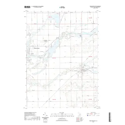
2019 Map of Three Rivers East
USGS Topo · Published 2019About this map
The confluence of the Portage River and the Saint Joseph River anchors the city of Three Rivers, Michigan, in this detailed 2019 survey. The area's water-rich geography is further defined by the Prairie River winding westward through Centreville, the county seat. This map highlights the region's long-standing institutional and cultural markers, from the Saint Joseph County Courthouse to the historic Langley Covered Bridge spanning the river. Local heritage is preserved in several mapped burial grounds, including the Amish Cem, Riverside Cem, and Culbertson Cem. Beyond the urban centers, the landscape transitions to a network of rural routes and lakes like Fishers Lake and Noah Lake, alongside specialized facilities like the Three Rivers Municipal Airport Dr Haines.
Find a feature on this map
116 named features on this map. Tap any name to fly to it.
Don’t see what you’re looking for? This feature index may not catch every label — zoom into the map to look around manually.
Map Details
Editions of this 2019 Three Rivers East Map
This is the sole edition of this map. No revisions or reprints were ever made.
Other maps of this area

1914 · Three Rivers
USGS Topo · 1:62,500

1916 · Three Rivers
USGS Topo · 1:62,500

1918 · Leonidas
USGS Topo · 1:62,500

1922 · Schoolcraft
USGS Topo · 1:62,500

1943 · Three Rivers
USGS Topo · 1:62,500

1943 · Schoolcraft
USGS Topo · 1:62,500

1944 · Leonidas
USGS Topo · 1:62,500

1947 · Leonidas
USGS Topo · 1:62,500

1950 · Leonidas
USGS Topo · 1:62,500

1953 · Fort Wayne
USGS Topo · 1:250,000