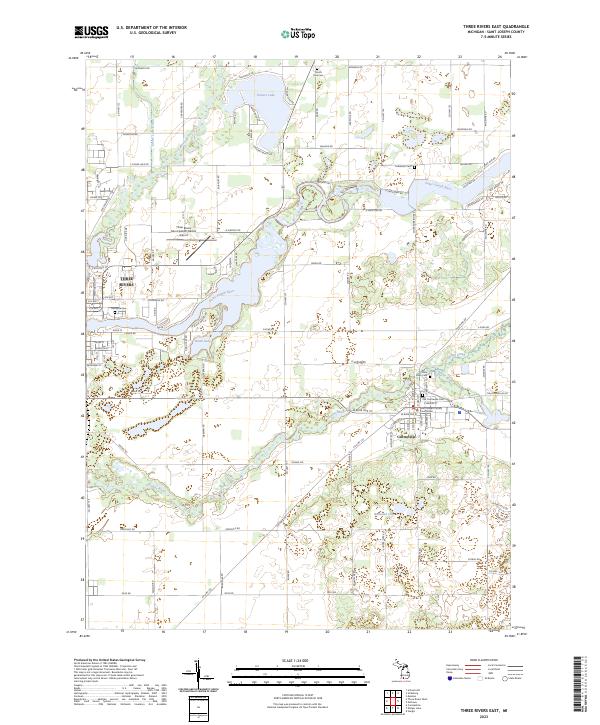
2023 Map of Three Rivers East
USGS Topo · Published 2023About this map
The Saint Joseph River and Prairie River converge in this section of southern Michigan, where the village of Centreville serves as a civic anchor. The landscape is defined by its glacial hydrology, featuring the expansive Fishers Lake to the north and numerous smaller water bodies like Noah Lake and Bullhead Lake. This document captures the administrative importance of the region, specifically noting the Saint Joseph County Courthouse in the heart of Centreville.
Find a feature on this map
118 named features on this map. Tap any name to fly to it.
Don’t see what you’re looking for? This feature index may not catch every label — zoom into the map to look around manually.
Map Details
Editions of this 2023 Three Rivers East Map
This is the sole edition of this map. No revisions or reprints were ever made.
Other maps of this area

1914 · Three Rivers
USGS Topo · 1:62,500

1916 · Three Rivers
USGS Topo · 1:62,500

1918 · Leonidas
USGS Topo · 1:62,500

1922 · Schoolcraft
USGS Topo · 1:62,500

1943 · Three Rivers
USGS Topo · 1:62,500

1943 · Schoolcraft
USGS Topo · 1:62,500

1944 · Leonidas
USGS Topo · 1:62,500

1947 · Leonidas
USGS Topo · 1:62,500

1950 · Leonidas
USGS Topo · 1:62,500

1953 · Fort Wayne
USGS Topo · 1:250,000