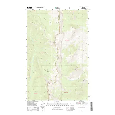
2017 Map of Three Sisters
USGS Topo · Published 2017About this map
The Lewis and Clark Range forms the backbone of this high-elevation landscape, where the administrative boundary between Flathead National Forest and Lewis & Clark National Forest follows the jagged ridgeline. This divide separates the watershed of the Spotted Bear River and its tributaries, like Goat Cr and Christopher Cr, from the eastern slopes. Distinctive peaks such as Hahn Peak and the namesake Three Sisters define the verticality of the terrain, while isolated water bodies like Hart Lake and Lake Quiet occupy the high basins. The drainage patterns of S Fork Red Shale Cr and Baldy-Bear Cr reflect the complex topography that has long challenged travel and surveying in this corner of the Rockies.
Find a feature on this map
23 named features on this map. Tap any name to fly to it.
Don’t see what you’re looking for? This feature index may not catch every label — zoom into the map to look around manually.
Map Details
Editions of this 2017 Three Sisters Map
This is the sole edition of this map. No revisions or reprints were ever made.
Other maps of this area

1903 · Saypo
USGS Topo · 1:125,000

1936 · Silvertip
USGS Topo · 1:96,000

1942 · Silvertip
USGS Topo · 1:125,000

1955 · Choteau
USGS Topo · 1:250,000

1957 · Choteau
USGS Topo · 1:250,000

1958 · Choteau
USGS Topo · 1:250,000

1958 · Porphyry Reef
USGS Topo · 1:24,000

1958 · Glenn Creek
USGS Topo · 1:24,000

1958 · Gates Park
USGS Topo · 1:24,000

1962 · Choteau
USGS Topo · 1:250,000