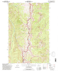
1995 Map of Three Sisters
USGS Topo · Published 1997About this map
The Continental Divide serves as the primary geographic and administrative axis for this 1995 revision, separating Flathead and Lewis and Clark Counties. This high-altitude landscape is defined by the intersection of the Bob Marshall Wilderness and the Sun River Game Preserve, showcasing a wilderness managed for conservation and recreation. The mapping of the Continental Divide Trail and the Scenic Trail indicates the importance of backcountry navigation in this roadless area.
Find a feature on this map
32 named features on this map. Tap any name to fly to it.
Don’t see what you’re looking for? This feature index may not catch every label — zoom into the map to look around manually.
Map Details
Editions of this 1995 Three Sisters Map
This is the sole edition of this map. No revisions or reprints were ever made.
Other maps of this area

1903 · Saypo
USGS Topo · 1:125,000

1936 · Silvertip
USGS Topo · 1:96,000

1942 · Silvertip
USGS Topo · 1:125,000

1955 · Choteau
USGS Topo · 1:250,000

1957 · Choteau
USGS Topo · 1:250,000

1958 · Choteau
USGS Topo · 1:250,000

1958 · Porphyry Reef
USGS Topo · 1:24,000

1958 · Glenn Creek
USGS Topo · 1:24,000

1958 · Gates Park
USGS Topo · 1:24,000

1962 · Choteau
USGS Topo · 1:250,000