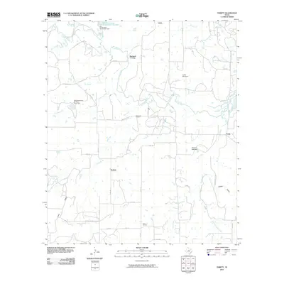
2010 Map of Thrifty
USGS Topo · Published 2010About this map
Jim Ned Creek and its numerous tributaries, including Little Mud Creek and Bee Branch, define the drainage patterns of this central Texas landscape. Small rural settlements like Thrifty and Fry are connected by a network of county roads and farm-to-market routes, reflecting the region's enduring agricultural and ranching character. The presence of Fairview Cemetery, Mud Creek Cemetery, and Salem Cemetery provides significant points of interest for genealogists tracing local families in Brown County.
Find a feature on this map
53 named features on this map. Tap any name to fly to it.
Don’t see what you’re looking for? This feature index may not catch every label — zoom into the map to look around manually.
Map Details
Editions of this 2010 Thrifty Map
This is the sole edition of this map. No revisions or reprints were ever made.
Other maps of this area

1887 · Coleman
USGS Topo · 1:125,000

1889 · Coleman
USGS Topo · 1:125,000

1924 · Coleman 1-a
USGS Topo · 1:48,000

1924 · Brownwood Reservoir Site
USGS Topo · 1:48,000

1927 · Grosvenor
USGS Topo · 1:62,500

1954 · Brownwood
USGS Topo · 1:250,000
1960 · Coleman NE
USGS Topo · 1:24,000
1960 · Burkett
USGS Topo · 1:24,000
1962 · Bangs East
USGS Topo · 1:24,000

1962 · Santa Anna
USGS Topo · 1:24,000