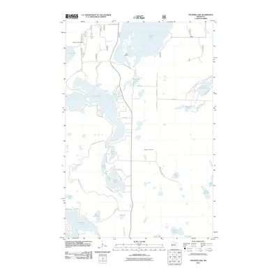
2011 Map of Thunder Lake
USGS Topo · Published 2011About this map
Big Rice Lake and the complex glacial basin of Thunder Lake dominate this northern Minnesota landscape, where an intricate network of township and county roads provides access to numerous smaller water bodies and shorelines. The map documents a territory defined by its hydrography, featuring distinct landmarks like the Draper Lookout Tower and the Steiner Landing Strip near Laura Lake. Transportation is primarily managed through routes such as County Hwy 7 and Ben Draper Forest Rd, which navigate between Pug Hole Lake and the southern reaches of Washburn Lake. The distribution of named roads like N Bass Lake Trl NE and S Thunder Lake Dr NE reflects a lakeside residential and recreational settlement pattern characteristic of the region's late-twentieth-century development.
Find a feature on this map
46 named features on this map. Tap any name to fly to it.
Don’t see what you’re looking for? This feature index may not catch every label — zoom into the map to look around manually.
Map Details
Editions of this 2011 Thunder Lake Map
This is the sole edition of this map. No revisions or reprints were ever made.
Other maps of this area

1953 · Duluth
USGS Topo · 1:250,000

1953 · Brainerd
USGS Topo · 1:250,000

1954 · Bemidji
USGS Topo · 1:250,000

1954 · Hibbing
USGS Topo · 1:250,000

1957 · Brainerd
USGS Topo · 1:250,000

1957 · Bemidji
USGS Topo · 1:250,000

1957 · Hibbing
USGS Topo · 1:250,000

1958 · Bemidji
USGS Topo · 1:250,000

1958 · Hibbing
USGS Topo · 1:250,000

1958 · Brainerd
USGS Topo · 1:250,000