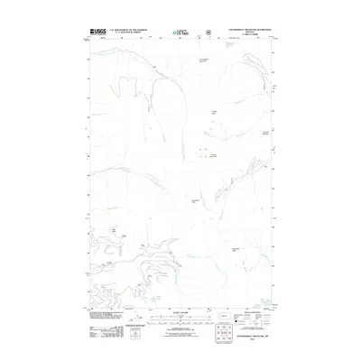
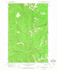
2011 Map of Thunderbolt Mountain
USGS Topo · Published 2011About this map
Thunderbolt Mountain and the high ridges of the Flathead National Forest dominate this landscape, which is defined by its complex drainage network and elevated observation points. The presence of the Little Napa Lookout underscores the area's history of wildfire management, positioned to oversee the canyons of Napa Creek and Soup Creek. Glacial activity has left behind distinct water bodies such as Bunker Lake and Scout Lake, which feed the numerous mountain tributaries including Warrior Creek and Goat Creek. The map documents a mostly inaccessible wilderness, where Lost Creek Rd provides a rare point of vehicle access to the northern reaches near South Fork Lost Creek. Historical travel routes are marked by Inspiration Pass, a high-altitude crossing situated between the drainages of Middle Fork Creek and Swift Creek.
Find a feature on this map
26 named features on this map. Tap any name to fly to it.
Don’t see what you’re looking for? This feature index may not catch every label — zoom into the map to look around manually.
Map Details
Editions of this 2011 Thunderbolt Mountain Map
This is the sole edition of this map. No revisions or reprints were ever made.
Other maps of this area

1955 · Choteau
USGS Topo · 1:250,000

1957 · Choteau
USGS Topo · 1:250,000

1958 · Choteau
USGS Topo · 1:250,000

1962 · Choteau
USGS Topo · 1:250,000
1965 · Connor Creek
USGS Topo · 1:24,000

1965 · Sunburst Lake
USGS Topo · 1:24,000
1965 · Swan Lake
USGS Topo · 1:24,000
1965 · Tin Creek
USGS Topo · 1:24,000
1965 · Thunderbolt Mountain
USGS Topo · 1:24,000

1965 · Swan Peak
USGS Topo · 1:24,000