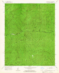
1964 Map of Thunderhead Mtn
USGS Topo · Published 1966About this map
Great Smoky Mountains National Park encompasses this entire high-altitude terrain along the border of Tennessee and North Carolina. The ridgeline serves as a literal and political divide, with the Appalachian Trail following the crest through prominent gaps and peaks like Mount Davis and the Sugar Tree Gap. This survey documents a landscape of deep drainages and named ridges, where historical human presence is marked by isolated structures such as the Spence Field Shelter and the Hall Cabin Ruins located near the Middle Prong Little River. The area around Tremont and Big Spring Cove shows the intricate network of watercourses, including Sams Creek and Lynn Camp Prong, that define the hydrology of the western Smokies. For researchers, the map provides a clear record of established hiking routes like the Jenkins Ridge Trail and family-named landmarks like Wilkinson Ridge during the mid-1960s.
Find a feature on this map
110 named features on this map. Tap any name to fly to it.
Don’t see what you’re looking for? This feature index may not catch every label — zoom into the map to look around manually.
Map Details
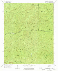
Editions of this 1964 Thunderhead Mtn Map
2 editions found
Other maps of this area

1886 · Knoxville
USGS Topo · 1:125,000

1892 · Knoxville
USGS Topo · 1:125,000

1894 · Knoxville
USGS Topo · 1:125,000

1895 · Knoxville
USGS Topo · 1:125,000

1901 · Knoxville
USGS Topo · 1:125,000

1933 · Bushnell
USGS Topo · 1:62,500

1935 · Fontana
USGS Topo · 1:24,000

1936 · Proctor
USGS Topo · 1:24,000
1936 · Gatlinburg
USGS Topo · 1:24,000
1936 · Judson
USGS Topo · 1:24,000