
1968 Map of Thurlow
USGS Topo · Published 1972About this map
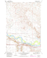
The Yellowstone River cuts a wide, braided path through this Rosebud County landscape, serving as the central artery for transportation and irrigation in the late 1960s. Along its northern banks, the Cartersville Canal parallels the river, feeding the agricultural valley near the small settlement of Thurlow. This area is a significant corridor of movement, where the historic Lewis and Clark Trail follows the river's southern curve, and two major rail lines, the Chicago Milwaukee St Paul and Pacific and the Burlington Northern, dominate the valley floor. Away from the water, the terrain rises into complex coulees and breaks, marked by landmarks like Jack Creek Hill and seasonal drainages such as Bull Creek and Goose Creek. Small locales like Joppa and Flynn are noted near the southern tracks, illustrating the scattered ranching and rail-dependent settlement pattern of the era.
Find a feature on this map
20 named features on this map. Tap any name to fly to it.
Don’t see what you’re looking for? This feature index may not catch every label — zoom into the map to look around manually.
Map Details
Editions of this 1968 Thurlow Map
2 editions found
Other maps of this area

1954 · Forsyth
USGS Topo · 1:250,000

1957 · Forsyth
USGS Topo · 1:250,000

1958 · Forsyth
USGS Topo · 1:250,000

1968 · Rosebud
USGS Topo · 1:24,000

1968 · Box Canyon Coulee
USGS Topo · 1:24,000

1968 · Sand Buttes
USGS Topo · 1:24,000

1968 · Hathaway
USGS Topo · 1:24,000

1968 · Hathaway NW
USGS Topo · 1:24,000
1969 · Miller Creek NW
USGS Topo · 1:24,000
1971 · Indian Creek
USGS Topo · 1:24,000