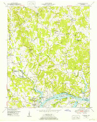
1949 Map of Thurman
USGS Topo · Published 1952About this map
The Tennessee River dominates this riverine landscape, defining the southern border of Decatur County and Hardin County. In the early 1950s, this reach of the river was a hive of activity, marked by numerous historical river access points such as Dickey Landing, Ladins Landing, and Point Pleasant Landing. The town of Saltillo serves as a focal point near the riverbanks, surrounded by a high density of community landmarks including St Marys Church, Morningview Church, and the Lincoln School.
Find a feature on this map
123 named features on this map. Tap any name to fly to it.
Don’t see what you’re looking for? This feature index may not catch every label — zoom into the map to look around manually.
Map Details
Editions of this 1949 Thurman Map
2 editions found
Other maps of this area

1936 · Hookers Bend
USGS Topo · 1:24,000

1936 · Scotts Hill
USGS Topo · 1:24,000

1936 · Thurman
USGS Topo · 1:24,000

1936 · Olivehill
USGS Topo · 1:24,000

1936 · Bath Springs
USGS Topo · 1:24,000

1936 · Sardis
USGS Topo · 1:24,000

1936 · Reagan
USGS Topo · 1:24,000

1936 · Milledgeville
USGS Topo · 1:24,000

1936 · Perryville
USGS Topo · 1:24,000

1949 · Perryville
USGS Topo · 1:24,000