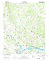
1949 Map of Thurman
USGS Topo · Published 1973About this map
The Tennessee River dominates the southern portion of this landscape, carving through the borderlands of Decatur and Hardin Counties. The riverfront economy of the mid-twentieth century is visible through numerous river access points such as Ladins Landing and Wyatt Landing, while natural landmarks like Swallow Bluff and Mule Cave define the rugged shoreline. Inland, the terrain is defined by a dense network of creek branches, including Stewman Creek and Doe Creek, which supported scattered rural communities during the late 1940s and early 1950s.
Find a feature on this map
91 named features on this map. Tap any name to fly to it.
Don’t see what you’re looking for? This feature index may not catch every label — zoom into the map to look around manually.
Map Details
Editions of this 1949 Thurman Map
2 editions found
Other maps of this area

1936 · Hookers Bend
USGS Topo · 1:24,000

1936 · Scotts Hill
USGS Topo · 1:24,000

1936 · Thurman
USGS Topo · 1:24,000

1936 · Olivehill
USGS Topo · 1:24,000

1936 · Bath Springs
USGS Topo · 1:24,000

1936 · Sardis
USGS Topo · 1:24,000

1936 · Reagan
USGS Topo · 1:24,000

1936 · Milledgeville
USGS Topo · 1:24,000

1936 · Perryville
USGS Topo · 1:24,000

1949 · Perryville
USGS Topo · 1:24,000