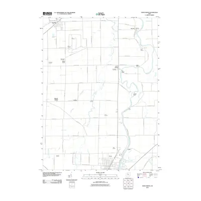
2010 Map of Tiffin North
USGS Topo · Published 2010About this map
The Sandusky River carves a winding path through this northern Ohio landscape, connecting the historic settlements of Old Fort and Fort Seneca. This area is defined by its deep agricultural roots and a network of township roads that segment the fertile plains between the river and the Wolf Creek drainage. The map reveals a dense concentration of local heritage sites, particularly cemeteries like Hite Cemetery, Pleasant Union Cemetery, and Shiloh Cemetery that serve as vital markers for genealogical research in Seneca County. In the southwest, the terrain rises at Mount Gilead near the small community of Cromers, while the modern infrastructure of Tiffin Airport and the village of Bettsville anchor the northern and southern reaches of the quadrangle. The presence of multiple post offices in small hamlets like Maple Grove illustrates the enduring importance of these community hubs in rural Ohio.
Find a feature on this map
80 named features on this map. Tap any name to fly to it.
Don’t see what you’re looking for? This feature index may not catch every label — zoom into the map to look around manually.
Map Details
Editions of this 2010 Tiffin North Map
This is the sole edition of this map. No revisions or reprints were ever made.
Other maps of this area

1901 · Fostoria
USGS Topo · 1:62,500

1901 · Fremont
USGS Topo · 1:62,500

1901 · Elmore
USGS Topo · 1:62,500

1903 · Fremont
USGS Topo · 1:62,500

1903 · Fostoria
USGS Topo · 1:62,500

1903 · Elmore
USGS Topo · 1:62,500

1906 · Tiffin
USGS Topo · 1:62,500

1956 · Toledo
USGS Topo · 1:250,000

1958 · Fremont West
USGS Topo · 1:24,000
1958 · Fremont East
USGS Topo · 1:24,000