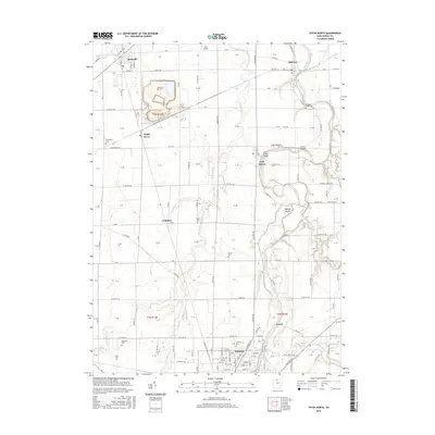
2016 Map of Tiffin North
USGS Topo · Published 2016About this map
Tiffin and its northern outskirts in Seneca County anchor this 2016 survey, where the Sandusky River winds northward through a landscape defined by traditional rural settlements and agricultural stretches. Historical continuity is visible in the numerous small family and community burial grounds, such as Hite Cem, Fravel Cem, and Shiloh Cem, which dot the townships of T3N R14E and T3N R15E. The river provides a central geographic corridor, crossed by the Fort Seneca Bridge and Abbotts Bridge near the island terrain of Abbotts Island.
Find a feature on this map
125 named features on this map. Tap any name to fly to it.
Don’t see what you’re looking for? This feature index may not catch every label — zoom into the map to look around manually.
Map Details
Editions of this 2016 Tiffin North Map
This is the sole edition of this map. No revisions or reprints were ever made.
Other maps of this area

1901 · Fostoria
USGS Topo · 1:62,500

1901 · Fremont
USGS Topo · 1:62,500

1901 · Elmore
USGS Topo · 1:62,500

1903 · Fremont
USGS Topo · 1:62,500

1903 · Fostoria
USGS Topo · 1:62,500

1903 · Elmore
USGS Topo · 1:62,500

1906 · Tiffin
USGS Topo · 1:62,500

1956 · Toledo
USGS Topo · 1:250,000

1958 · Fremont West
USGS Topo · 1:24,000
1958 · Fremont East
USGS Topo · 1:24,000