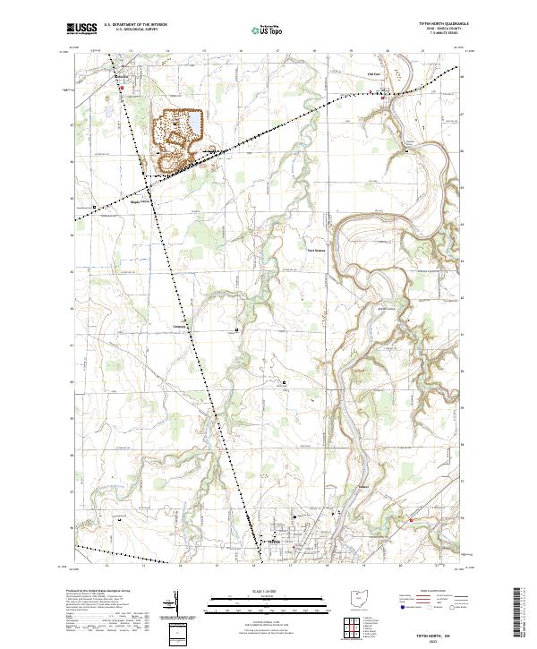
2023 Map of Tiffin North
USGS Topo · Published 2023About this map
The Sandusky River winds northward through this portion of Seneca County, serving as a primary corridor for the communities of Fort Seneca and Old Fort. To the south, the northern periphery of Tiffin is visible, showing a dense street grid including 8th Ave and Dallas St. The landscape is defined by its drainage systems, where East Branch Wolf Creek and Snuff Creek intersect the agricultural tableland between smaller settlements like Maple Grove and Cromers.
Find a feature on this map
124 named features on this map. Tap any name to fly to it.
Don’t see what you’re looking for? This feature index may not catch every label — zoom into the map to look around manually.
Map Details
Editions of this 2023 Tiffin North Map
This is the sole edition of this map. No revisions or reprints were ever made.
Other maps of this area

1901 · Fostoria
USGS Topo · 1:62,500

1901 · Fremont
USGS Topo · 1:62,500

1901 · Elmore
USGS Topo · 1:62,500

1903 · Fremont
USGS Topo · 1:62,500

1903 · Fostoria
USGS Topo · 1:62,500

1903 · Elmore
USGS Topo · 1:62,500

1906 · Tiffin
USGS Topo · 1:62,500

1956 · Toledo
USGS Topo · 1:250,000

1958 · Fremont West
USGS Topo · 1:24,000
1958 · Fremont East
USGS Topo · 1:24,000