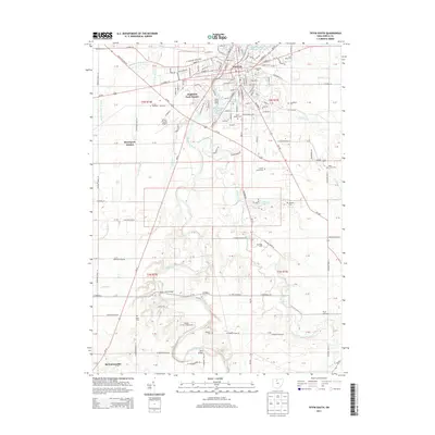
2013 Map of Tiffin South
USGS Topo · Published 2013About this map
Tiffin anchors this Seneca County landscape, situated where the Sandusky River turns north. The city's footprint includes the campus of Heidelberg Univ and industrial sites like the Tiffin Water Works. To the south, the river meanders through a mix of woodland and agricultural tracts, passing the Saint Johns Bridge and local recreation sites such as Camp Glen and the Walnut Grove Campground.
Find a feature on this map
173 named features on this map. Tap any name to fly to it.
Don’t see what you’re looking for? This feature index may not catch every label — zoom into the map to look around manually.
Map Details
Editions of this 2013 Tiffin South Map
This is the sole edition of this map. No revisions or reprints were ever made.
Other maps of this area

1901 · Fostoria
USGS Topo · 1:62,500

1903 · Fostoria
USGS Topo · 1:62,500

1906 · Sycamore
USGS Topo · 1:62,500

1906 · Tiffin
USGS Topo · 1:62,500

1907 · Upper Sandusky
USGS Topo · 1:62,500

1950 · Marion
USGS Topo · 1:250,000

1956 · Toledo
USGS Topo · 1:250,000

1960 · Sycamore
USGS Topo · 1:24,000
1960 · Watson
USGS Topo · 1:24,000

1960 · Tiffin South
USGS Topo · 1:24,000