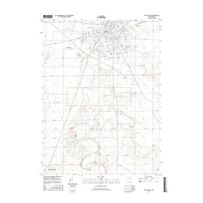
2016 Map of Tiffin South
USGS Topo · Published 2016About this map
Tiffin serves as the focal point for this survey of south-central Seneca County, where the Sandusky River winds through a landscape of established educational institutions and scattered rural cemeteries. The presence of Heidelberg Univ and Tiffin Univ underscores the city's role as a regional center of learning. To the south, the terrain opens into a series of creek valleys and agricultural tracts, including the waters of Honey Creek and the man-made Mohawk Lake. Local history and genealogy are well-represented by a high density of burial grounds such as Greenlawn Cem, Rock Creek Cem, and Saint Marys Cem. Near the southern edge of the sheet, the settlement of McCutchenville sits at a crossroads, while the Seneca County Airport marks the transition between urban development and the surrounding townships.
Find a feature on this map
103 named features on this map. Tap any name to fly to it.
Don’t see what you’re looking for? This feature index may not catch every label — zoom into the map to look around manually.
Map Details
Editions of this 2016 Tiffin South Map
This is the sole edition of this map. No revisions or reprints were ever made.
Other maps of this area

1901 · Fostoria
USGS Topo · 1:62,500

1903 · Fostoria
USGS Topo · 1:62,500

1906 · Sycamore
USGS Topo · 1:62,500

1906 · Tiffin
USGS Topo · 1:62,500

1907 · Upper Sandusky
USGS Topo · 1:62,500

1950 · Marion
USGS Topo · 1:250,000

1956 · Toledo
USGS Topo · 1:250,000

1960 · Sycamore
USGS Topo · 1:24,000
1960 · Watson
USGS Topo · 1:24,000

1960 · Tiffin South
USGS Topo · 1:24,000