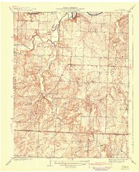
1941 Map of Tiffin
USGS Topo · Published 1941About this map
Tiffin and the surrounding townships of East Speedwell and West Speedwell define this rural landscape during the late 1930s. The area is characterized by a high density of one-room schoolhouses and rural churches, such as Ruark Sch, Snyder Sch, and the Pape Ch, which served as the social anchors for scattered farmsteads. The winding Osage River marks the northern boundary, overlooked by the prominent Rock House Bluff.
Find a feature on this map
28 named features on this map. Tap any name to fly to it.
Don’t see what you’re looking for? This feature index may not catch every label — zoom into the map to look around manually.
Map Details
Editions of this 1941 Tiffin Map
2 editions found
Other maps of this area

1886 · Nevada
USGS Topo · 1:125,000

1886 · Stockton
USGS Topo · 1:125,000

1887 · Clinton
USGS Topo · 1:125,000

1887 · Butler
USGS Topo · 1:125,000

1894 · Butler
USGS Topo · 1:125,000

1894 · Nevada
USGS Topo · 1:125,000

1894 · Clinton
USGS Topo · 1:125,000

1934 · Rockville
USGS Topo · 1:24,000

1937 · Tiffin
USGS Topo · 1:31,680

1938 · Monegaw Springs
USGS Topo · 1:24,000