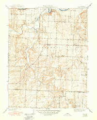
1941 Map of Tiffin
USGS Topo · Published 1950About this map
Osage River winds through the northern reaches of this Missouri landscape, framed by the dramatic Rock House Bluff as it cuts through the border between East Speedwell and the surrounding townships. The area is defined by a dense network of country school districts and small crossroads settlements, reflecting a mid-century rural society still centered around local institutions like Blue Ridge Sch, Arrarat Sch, and the community at Tiffin. These schools, spaced for walking or horse-drawn travel, show the persistence of localized education before widespread district consolidation.
Find a feature on this map
28 named features on this map. Tap any name to fly to it.
Don’t see what you’re looking for? This feature index may not catch every label — zoom into the map to look around manually.
Map Details
Editions of this 1941 Tiffin Map
2 editions found
Other maps of this area

1886 · Nevada
USGS Topo · 1:125,000

1886 · Stockton
USGS Topo · 1:125,000

1887 · Clinton
USGS Topo · 1:125,000

1887 · Butler
USGS Topo · 1:125,000

1894 · Butler
USGS Topo · 1:125,000

1894 · Nevada
USGS Topo · 1:125,000

1894 · Clinton
USGS Topo · 1:125,000

1934 · Rockville
USGS Topo · 1:24,000

1937 · Tiffin
USGS Topo · 1:31,680

1938 · Monegaw Springs
USGS Topo · 1:24,000