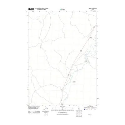
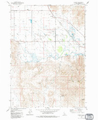
2010 Map of Tikura
USGS Topo · Published 2010About this map
Tikura and the surrounding high desert of Blaine County are defined by the critical water resources of the Little Wood River and Silver Creek during the first decade of the 2000s. The landscape is characterized by its transportation history, showing the alignment of the Old Hwy and Old State Hwy alongside modern routes. Agricultural and transit waypoints like Halfway House and Pagari Bridge reflect the long-standing importance of this corridor for movement through the region. Public access areas, such as the Taylor Bear Tracks - Williams Access Area and Preacher Bridge Access Area, emphasize the dual nature of the river as both a life-giving resource and a recreational destination. The map also traces remote desert infrastructure including Desert Rd and the Preacher Bridges-Sand Butte Rd, which connect the waterway to the broader Idaho interior.
Find a feature on this map
14 named features on this map. Tap any name to fly to it.
Don’t see what you’re looking for? This feature index may not catch every label — zoom into the map to look around manually.
Map Details
Editions of this 2010 Tikura Map
This is the sole edition of this map. No revisions or reprints were ever made.
Other maps of this area

1955 · Idaho Falls
USGS Topo · 1:250,000

1955 · Hailey
USGS Topo · 1:250,000

1958 · Idaho Falls
USGS Topo · 1:250,000

1959 · Hailey
USGS Topo · 1:250,000

1962 · Hailey
USGS Topo · 1:250,000

1978 · Craters Of The Moon
USGS Topo · 1:100,000
1979 · Richfield
USGS Topo · 1:24,000
1979 · Black Ridge Crater
USGS Topo · 1:24,000
1979 · Tapper Lake
USGS Topo · 1:24,000
1979 · Gannett
USGS Topo · 1:24,000