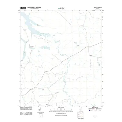
2011 Map of Tilden
USGS Topo · Published 2011About this map
Pine Barren Creek winds extensively through the central portion of this Dallas County landscape, eventually meeting the Alabama River along the western edge of the sheet. The settlement of Tilden serves as a local focal point, surrounded by numerous family and community landmarks such as Butler Cemetery and Boykin Cemetery. This area in 2011 maintains a largely rural character, defined by the river’s features like Hurricane Bluff and Saint John Bar, alongside agricultural and forestry access provided by Flatwood Plantation Rd. Water management and local education history are noted through the Choctaw County School Lake and various impoundments like Frank Cothran Dam. For genealogists, the map is particularly useful for locating the Older Hill Cemetery and Society Hill Cemetery near the southern border.
Find a feature on this map
27 named features on this map. Tap any name to fly to it.
Don’t see what you’re looking for? This feature index may not catch every label — zoom into the map to look around manually.
Map Details
Editions of this 2011 Tilden Map
This is the sole edition of this map. No revisions or reprints were ever made.
Other maps of this area

1953 · Montgomery
USGS Topo · 1:250,000

1953 · Andalusia
USGS Topo · 1:250,000

1956 · Montgomery
USGS Topo · 1:250,000

1957 · Montgomery
USGS Topo · 1:250,000

1957 · Andalusia
USGS Topo · 1:250,000

1957 · Carlowville
USGS Topo · 1:62,500

1973 · Camden South
USGS Topo · 1:24,000

1974 · Crumptonia
USGS Topo · 1:24,000
1974 · Camden North
USGS Topo · 1:24,000

1975 · Carlowville NE
USGS Topo · 1:24,000