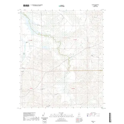
2020 Map of Tilden
USGS Topo · Published 2020About this map
The Alabama River carves the western boundary of this landscape, featuring prominent landmarks like Hurricane Bluff and Saint John Bar. The interior is defined by the winding course of Pine Barren Creek as it moves south toward the Dallas Co Wilcox Co line. This region is characterized by small rural settlements and a scattering of family and community burial grounds, which serve as vital markers for local genealogy.
Find a feature on this map
33 named features on this map. Tap any name to fly to it.
Don’t see what you’re looking for? This feature index may not catch every label — zoom into the map to look around manually.
Map Details
Editions of this 2020 Tilden Map
This is the sole edition of this map. No revisions or reprints were ever made.
Other maps of this area

1953 · Montgomery
USGS Topo · 1:250,000

1953 · Andalusia
USGS Topo · 1:250,000

1956 · Montgomery
USGS Topo · 1:250,000

1957 · Montgomery
USGS Topo · 1:250,000

1957 · Andalusia
USGS Topo · 1:250,000

1957 · Carlowville
USGS Topo · 1:62,500

1973 · Camden South
USGS Topo · 1:24,000

1974 · Crumptonia
USGS Topo · 1:24,000
1974 · Camden North
USGS Topo · 1:24,000

1975 · Carlowville NE
USGS Topo · 1:24,000