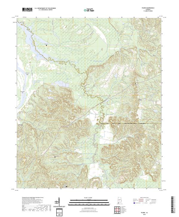
2024 Map of Tilden
USGS Topo · Published 2024About this map
The Alabama River carves a sharp western boundary through this corner of Wilcox County, creating distinct terrain features such as Hurricane Bluff and the Saint John Bar. The landscape is defined by the winding course of Pine Barren Creek and its many tributaries, which cut through the hills of the southern Alabama interior. Small settlements like Tilden and the modern development at Sakti Hata are scattered across the terrain, connected by a network of rural routes including Sadler Bridge Rd and Youngblood Rd.
Find a feature on this map
30 named features on this map. Tap any name to fly to it.
Don’t see what you’re looking for? This feature index may not catch every label — zoom into the map to look around manually.
Map Details
Editions of this 2024 Tilden Map
This is the sole edition of this map. No revisions or reprints were ever made.
Other maps of this area

1953 · Montgomery
USGS Topo · 1:250,000

1953 · Andalusia
USGS Topo · 1:250,000

1956 · Montgomery
USGS Topo · 1:250,000

1957 · Montgomery
USGS Topo · 1:250,000

1957 · Andalusia
USGS Topo · 1:250,000

1957 · Carlowville
USGS Topo · 1:62,500

1973 · Camden South
USGS Topo · 1:24,000

1974 · Crumptonia
USGS Topo · 1:24,000
1974 · Camden North
USGS Topo · 1:24,000

1975 · Carlowville NE
USGS Topo · 1:24,000