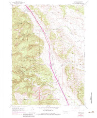
1953 Map of Tilford
USGS Topo · Published 1983About this map
Black Hills National Cemetery stands as a prominent landmark in this 1953 survey, situated along the Chicago and North Western rail line. The settlement of Tilford occupies the valley floor, where the industrial presence of a Gravel Pit and proximity to the Fort Meade Military Boundary define the local economy. The landscape is characterized by numerous named drainages, including Alkali Creek, Bulldog Gulch, and Breakneck Gulch, which carve through the rising elevations of the Black Hills National Forest.
Find a feature on this map
23 named features on this map. Tap any name to fly to it.
Don’t see what you’re looking for? This feature index may not catch every label — zoom into the map to look around manually.
Map Details
Editions of this 1953 Tilford Map
4 editions found
Other maps of this area

1893 · Rapid
USGS Topo · 1:125,000

1894 · Deadwood
USGS Topo · 1:125,000

1898 · Rapid
USGS Topo · 1:125,000

1899 · Sturgis
USGS Topo · 1:62,500

1901 · Deadwood
USGS Topo · 1:125,000

1903 · Rapid
USGS Topo · 1:125,000

1915 · Sturgis
USGS Topo · 1:62,500

1916 · Deadwood
USGS Topo · 1:125,000

1953 · Blackhawk
USGS Topo · 1:24,000

1953 · Piedmont
USGS Topo · 1:24,000