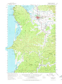
1955 Map of Tillamook
USGS Topo · Published 1973About this map
Tillamook serves as the focal point of this mid-century coastal survey, situated where the Wilson River and Trask River empty into the expansive Tillamook Bay. The landscape transitions from the developed town center to the dense timberlands of the Siuslaw National Forest and the rugged coastline. A significant military presence is noted at the Naval Air Station south of town, reflecting the era's regional defense infrastructure.
Find a feature on this map
43 named features on this map. Tap any name to fly to it.
Don’t see what you’re looking for? This feature index may not catch every label — zoom into the map to look around manually.
Map Details
Editions of this 1955 Tillamook Map
3 editions found

Other maps of this area

1937 · Nehalem
USGS Topo · 1:62,500

1937 · Enright
USGS Topo · 1:62,500

1941 · Nestucca Bay
USGS Topo · 1:62,500

1941 · Enright
USGS Topo · 1:62,500

1942 · Ginger Peak
USGS Topo · 1:62,500

1942 · Spirit Mtn
USGS Topo · 1:62,500

1942 · Nestucca Bay
USGS Topo · 1:62,500

1942 · Tillamook
USGS Topo · 1:62,500

1943 · Nehalem
USGS Topo · 1:62,500

1948 · Vancouver
USGS Topo · 1:250,000