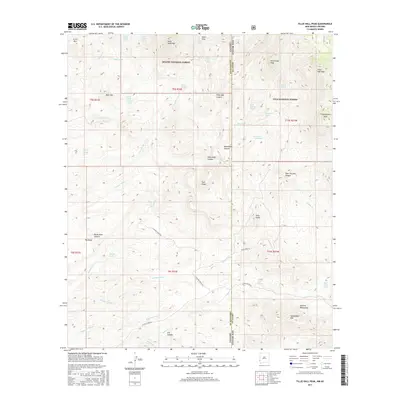
2017 Map of Tillie Hall Peak
USGS Topo · Published 2017About this map
The Apache National Forest and Gila National Forest meet along the high desert border of New Mexico and Arizona in this 2017 study. The landscape is defined by its dramatic relief and drainage systems, where water sources like Middle Linden Spring and Hells Hole Spring are critical markers in an arid environment. Cattle ranching and land management legacy is evident in the inclusion of Stauffer Ranch Rd and various water catchments such as Corner Tank and Franks Tank. Prominent landmarks including Tillie Hall Peak, Winchester Peak, and the twin summits of Twin Peaks provide significant topographic orientation. The drainage network is complex, characterized by the winding paths of Wampoo Wash, Bitter Cr, and Linden Cr, which have carved deep features like Tillie Hall Canyon and Dark Thunder Canyon.
Find a feature on this map
54 named features on this map. Tap any name to fly to it.
Don’t see what you’re looking for? This feature index may not catch every label — zoom into the map to look around manually.
Map Details
Editions of this 2017 Tillie Hall Peak Map
This is the sole edition of this map. No revisions or reprints were ever made.
Other maps of this area
1910 · Mogollon
USGS Topo · 1:125,000
1912 · Mogollon
USGS Topo · 1:125,000
1913 · Morenci
USGS Topo · 1:125,000
1915 · Morenci
USGS Topo · 1:125,000

1954 · Silver City
USGS Topo · 1:250,000

1954 · Clifton
USGS Topo · 1:250,000

1957 · Clifton
USGS Topo · 1:250,000

1958 · Silver City
USGS Topo · 1:250,000

1958 · Clifton
USGS Topo · 1:250,000
1959 · Steeple Rock
USGS Topo · 1:62,500