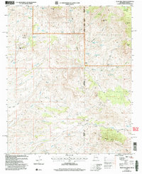
2005 Map of Tillie Hall Peak
USGS Topo · Published 2006About this map
Skully Creek Ranch and 4L Bar Ranch sit within a high-altitude landscape where the Apache National Forest meets the Gila National Forest. This 2005 revision records the remote borderlands between Arizona and New Mexico, defined by the Summit Mountains and peaks such as Tillie Hall Peak and Hells Hole Peak. The map reveals a network of high-country water sources essential for livestock and survival, including Hells Hole Spring, Water Haul Spring, and Breaking Iron Spring.
Find a feature on this map
55 named features on this map. Tap any name to fly to it.
Don’t see what you’re looking for? This feature index may not catch every label — zoom into the map to look around manually.
Map Details
Editions of this 2005 Tillie Hall Peak Map
This is the sole edition of this map. No revisions or reprints were ever made.
Other maps of this area

1910 · Mogollon
USGS Topo · 1:125,000

1912 · Mogollon
USGS Topo · 1:125,000

1913 · Morenci
USGS Topo · 1:125,000

1915 · Morenci
USGS Topo · 1:125,000

1954 · Silver City
USGS Topo · 1:250,000

1954 · Clifton
USGS Topo · 1:250,000

1957 · Clifton
USGS Topo · 1:250,000

1958 · Silver City
USGS Topo · 1:250,000

1958 · Clifton
USGS Topo · 1:250,000

1959 · Steeple Rock
USGS Topo · 1:62,500