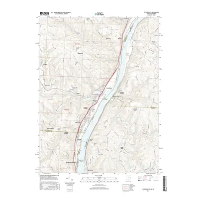
2016 Map of Tiltonsville
USGS Topo · Published 2016About this map
The Ohio River carves a deep valley through the tri-state border region, separating the industrial and residential riverfronts of Ohio and West Virginia. This corridor is defined by a dense sequence of settlements including Tiltonsville, Rayland, and Martins Ferry on the western bank, mirrored by Beech Bottom and Power on the eastern side. The map illustrates a landscape of deep hollows and steep ridges, where small creeks like Rush Run and Short Creek have created natural breaks in the topography for inland development.
Find a feature on this map
71 named features on this map. Tap any name to fly to it.
Don’t see what you’re looking for? This feature index may not catch every label — zoom into the map to look around manually.
Map Details
Editions of this 2016 Tiltonsville Map
This is the sole edition of this map. No revisions or reprints were ever made.
Other maps of this area

1901 · Cadiz
USGS Topo · 1:62,500

1902 · Wheeling
USGS Topo · 1:62,500

1903 · Cadiz
USGS Topo · 1:62,500

1904 · Steubenville
USGS Topo · 1:62,500

1905 · St. Clairsville
USGS Topo · 1:62,500

1935 · Wheeling
USGS Topo · 1:62,500

1935 · Steubenville
USGS Topo · 1:62,500

1942 · Wheeling
USGS Topo · 1:62,500

1942 · Steubenville
USGS Topo · 1:62,500

1951 · Canton
USGS Topo · 1:250,000