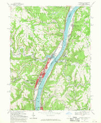
1968 Map of Tiltonsville
USGS Topo · Published 1970About this map
The Ohio River corridor north of Wheeling serves as a dense industrial and transit artery in this late-1960s survey. The landscape is defined by the sharp contrast between the active riverside settlements like Tiltonsville, Yorkville, and Rayland and the deeply incised, mine-scarred ridges that overlook them. Extensive strip mining and numerous mine dumps are evident across Chestnut Ridge and the hills surrounding Glen Robbins, while the river itself is managed via the Pike Island Lock and Dam. This era shows the mature rail infrastructure of the Penn Central and Norfolk and Western lines hugging the banks. Local history is anchored by landmarks like Warren High School, Mazeroski Park, and several country churches including Rush Run Chapel and Kadesh Chapel, while the Wheeling-Ohio County Airport occupies the high ground to the east in West Virginia.
Find a feature on this map
78 named features on this map. Tap any name to fly to it.
Don’t see what you’re looking for? This feature index may not catch every label — zoom into the map to look around manually.
Map Details
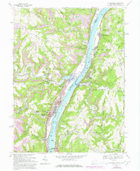
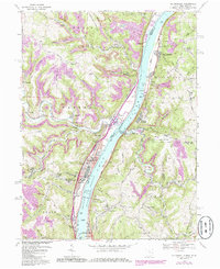
Editions of this 1968 Tiltonsville Map
Other maps of this area

1901 · Cadiz
USGS Topo · 1:62,500

1902 · Wheeling
USGS Topo · 1:62,500

1903 · Cadiz
USGS Topo · 1:62,500

1904 · Steubenville
USGS Topo · 1:62,500

1905 · St. Clairsville
USGS Topo · 1:62,500

1935 · Wheeling
USGS Topo · 1:62,500

1935 · Steubenville
USGS Topo · 1:62,500

1942 · Wheeling
USGS Topo · 1:62,500

1942 · Steubenville
USGS Topo · 1:62,500

1951 · Canton
USGS Topo · 1:250,000