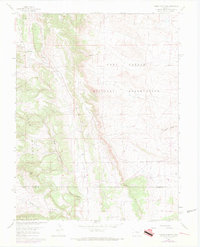
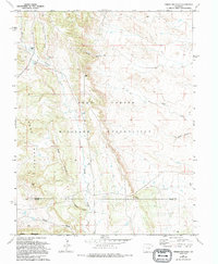
1961 Map of Timber Mountain
USGS Topo · Published 1970About this map
The Fort Carson Military Reservation dominates the landscape of this high-country terrain south of Colorado Springs, where the foothills meet the plains. Mapping by the Geological Survey and Corps of Engineers reveals a complex drainage system led by Turkey Creek and Little Turkey Creek, cutting through prominent elevations like Timber Mountain and Buck Hill. The map highlights the intersection of military utility and natural topography, with a prominent Landing Strip and a network of unimproved roads branching off from Lytle Road.
Find a feature on this map
15 named features on this map. Tap any name to fly to it.
Don’t see what you’re looking for? This feature index may not catch every label — zoom into the map to look around manually.
Map Details
Editions of this 1961 Timber Mountain Map
6 editions found

Other maps of this area

1891 · Pueblo
USGS Topo · 1:125,000

1893 · Colorado Springs
USGS Topo · 1:125,000

1894 · Pueblo
USGS Topo · 1:125,000

1896 · Pueblo
USGS Topo · 1:125,000

1897 · Pueblo
USGS Topo · 1:125,000

1909 · Colorado Springs
USGS Topo · 1:125,000

1942 · Colorado Springs
USGS Topo · 1:125,000

1948 · Mount Big Chief
USGS Topo · 1:24,000

1948 · Mount Pittsburg
USGS Topo · 1:24,000

1948 · Timber Mountain
USGS Topo · 1:24,000