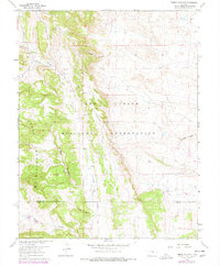
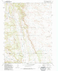
1961 Map of Timber Mountain
USGS Topo · Published 1977About this map
The Fort Carson Military Reservation dominates this Colorado landscape, characterized by a series of steep ridges and deep drainage systems that transition between the foothills and the plains. This 1961 survey, with photorevisions through the mid-1970s, captures the rugged geography of Timber Mountain and Buck Hill while documenting the boundary between El Paso and Pueblo counties. The movement of water has carved a complex network of canyons, including Crooked Canyon, Rule Canyon, and Orchard Canyon, which flow into the larger Turkey Creek valley. Human activity is largely defined by military infrastructure and resource extraction, evidenced by a Landing Strip and an active Quarry. Lytle Road serves as the primary corridor through the western portion of the map, providing access to these upland areas and the various drainage basins like Sullivan Canyon.
Find a feature on this map
16 named features on this map. Tap any name to fly to it.
Don’t see what you’re looking for? This feature index may not catch every label — zoom into the map to look around manually.
Map Details
Editions of this 1961 Timber Mountain Map
6 editions found

Other maps of this area

1891 · Pueblo
USGS Topo · 1:125,000

1893 · Colorado Springs
USGS Topo · 1:125,000

1894 · Pueblo
USGS Topo · 1:125,000

1896 · Pueblo
USGS Topo · 1:125,000

1897 · Pueblo
USGS Topo · 1:125,000

1909 · Colorado Springs
USGS Topo · 1:125,000

1942 · Colorado Springs
USGS Topo · 1:125,000

1948 · Mount Big Chief
USGS Topo · 1:24,000

1948 · Mount Pittsburg
USGS Topo · 1:24,000

1948 · Timber Mountain
USGS Topo · 1:24,000