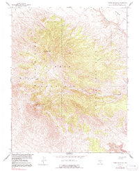
1961 Map of Timber Mountain
USGS Topo · Published 1991About this map
Timber Mountain dominates this high-altitude desert terrain, where early 1960s mapping efforts were coordinated between the Geological Survey and the Atomic Energy Commission. The landscape is defined by its isolation and its role in mid-century national security, as the land is split between the Nellis Air Force Range and the Nevada Test Site. Notable summits include North Timber Peak and South Timber Peak, which overlook a network of deep incisions such as Fortymile Canyon and Cat Canyon. This region is characterized by sparse infrastructure, with only rudimentary 4wd tracks traversing the complex topography. To the northeast, the elevated expanse of Buckboard Mesa and the curious Brushy Area provide distinct landmarks in a territory otherwise defined by winding drainages like Three Forks Wash and Chukar Canyon.
Find a feature on this map
12 named features on this map. Tap any name to fly to it.
Don’t see what you’re looking for? This feature index may not catch every label — zoom into the map to look around manually.
Map Details
Editions of this 1961 Timber Mountain Map
3 editions found
Other maps of this area

1908 · Kawich
USGS Topo · 1:250,000

1908 · Furnace Creek
USGS Topo · 1:250,000

1910 · Furnace Creek
USGS Topo · 1:250,000

1942 · Tolicha Peak
USGS Topo · 1:125,000

1942 · Wheelbarrow Peak
USGS Topo · 1:125,000

1942 · Skull Mountain
USGS Topo · 1:125,000

1942 · Bullfrog
USGS Topo · 1:125,000

1948 · Death Valley
USGS Topo · 1:250,000

1952 · Topopah Spring
USGS Topo · 1:62,500

1952 · Timber Mountain
USGS Topo · 1:62,500