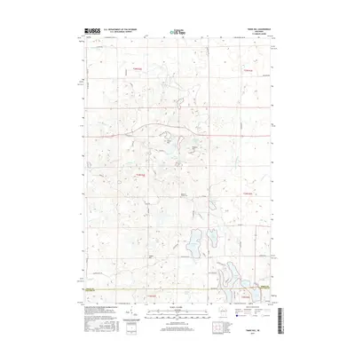
2015 Map of Timms Hill
USGS Topo · Published 2015About this map
Timms Hill, the highest point in Wisconsin, dominates this landscape at the intersection of the Price Co and Taylor Co line. This glaciated terrain is defined by a dense network of kettle lakes and erratic drainage patterns, including Thirtyfive Lakes, Bergeson Lake, and the winding N Fork Spirit River. The map captures a transitional wilderness character where the Ice Age Trl weaves through a complex of modest peaks like Pearson Hill and Spokes Hill. Local landmarks such as the Garden of Memory Cem and various family-named roads like Hultman Rd and Risberg Rd reflect a history of sparse settlement and forestry. The southern portion of the quadrangle shows the headwaters of the Spirit River, as the water moves through N Spirit Lake and Spirit Lake toward the Mississippi watershed.
Find a feature on this map
65 named features on this map. Tap any name to fly to it.
Don’t see what you’re looking for? This feature index may not catch every label — zoom into the map to look around manually.
Map Details
Editions of this 2015 Timms Hill Map
This is the sole edition of this map. No revisions or reprints were ever made.
Other maps of this area

1941 · Phillips
USGS Topo · 1:48,000

1941 · Brantwood
USGS Topo · 1:48,000

1943 · Philliips
USGS Topo · 1:48,000

1943 · Brantwood
USGS Topo · 1:48,000

1944 · Ogema
USGS Topo · 1:48,000

1945 · Rib Lake
USGS Topo · 1:48,000

1947 · Rib Lake
USGS Topo · 1:48,000

1947 · Ogema
USGS Topo · 1:48,000

1949 · Ogema
USGS Topo · 1:48,000

1949 · Rib Lake
USGS Topo · 1:48,000