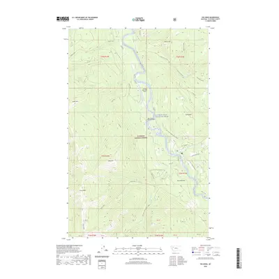
2020 Map of Tin Creek
USGS Topo · Published 2020About this map
Soldier Creek defines the drainage of this high-elevation mountain terrain within the northern Rockies. The landscape is characterized by steep ridges and narrow valleys, where small tributaries like Soldier Creek flow through the Flathead National Forest. This modern topographic study provides an exact record of the hydrological patterns and elevation contours of the region. The absence of developed roads and settlements underscores the wild character of this protected forest land, making the map a primary reference for understanding the natural drainage system of the upper Flathead area.
Find a feature on this map
2 named features on this map. Tap any name to fly to it.
Don’t see what you’re looking for? This feature index may not catch every label — zoom into the map to look around manually.
Map Details
Editions of this 2020 Tin Creek Map
This is the sole edition of this map. No revisions or reprints were ever made.
Other maps of this area

1913 · Marias Pass
USGS Topo · 1:125,000

1914 · Nyack
USGS Topo · 1:125,000

1936 · Silvertip
USGS Topo · 1:96,000

1942 · Silvertip
USGS Topo · 1:125,000

1955 · Choteau
USGS Topo · 1:250,000

1957 · Choteau
USGS Topo · 1:250,000

1958 · Choteau
USGS Topo · 1:250,000

1958 · Circus Peak
USGS Topo · 1:24,000

1958 · Quintonkon
USGS Topo · 1:24,000

1958 · Horseshoe Peak
USGS Topo · 1:24,000