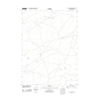
2012 Map of Tin Cup Mountain
USGS Topo · Published 2012About this map
Tin Cup Mountain and the surrounding high-altitude terrain define this 2012 survey of the Granite Mountains region in central Wyoming. The landscape is marked by prominent geological breaks such as Beaver Rim and Beaver Divide, which overlook a network of high-desert drainages and ranching operations. Human presence is concentrated around family-named landmarks and water sources, including the Givens Homestead and Long Creek Ranch. Resource extraction and water management are central to this area's history, evidenced by the Tin Cup Mine tucked near the mountain's base and several man-made catchments like the Daniel F Hudson Reservoir. The map illustrates the careful distribution of water in an arid environment, tracing the flow from Findlay Springs and Tin Cup Spring into the various forks of Tin Cup Cr and Long Cr.
Find a feature on this map
14 named features on this map. Tap any name to fly to it.
Don’t see what you’re looking for? This feature index may not catch every label — zoom into the map to look around manually.
Map Details
Editions of this 2012 Tin Cup Mountain Map
This is the sole edition of this map. No revisions or reprints were ever made.
Other maps of this area

1951 · Stampede Meadow
USGS Topo · 1:24,000

1951 · Graham Ranch
USGS Topo · 1:24,000

1951 · Myers Ranch
USGS Topo · 1:24,000

1952 · Tin Cup Mountain
USGS Topo · 1:24,000

1952 · Muskrat Basin
USGS Topo · 1:24,000

1952 · Rongis Reservoir SE
USGS Topo · 1:24,000

1952 · Rongis Reservoir
USGS Topo · 1:24,000

1953 · Blue Gulch
USGS Topo · 1:24,000

1953 · Elkhorn Springs
USGS Topo · 1:24,000

1955 · Lander
USGS Topo · 1:250,000