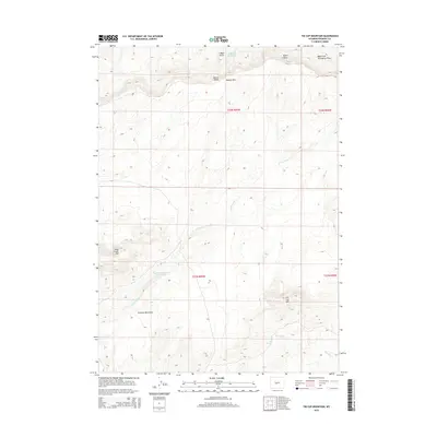
2015 Map of Tin Cup Mountain
USGS Topo · Published 2015About this map
The high desert landscape of central Wyoming is defined here by the prominent Beaver Divide and Beaver Rim, which separate the drainage basins of the region. This 2015 survey details a topography shaped by seasonal water and high-altitude features, including the Granite Mountains and peaks like Tin Cup Mtn and Long Creek Mtn. The map reveals a reliance on managed water sources in this arid environment, evidenced by the Daniel F Hudson Reservoir and Findlay Reservoir. These water bodies, along with perennial points like Findlay Springs and Tin Cup Spring, represent critical infrastructure for ranching and wildlife in Fremont County. The drainage network is characterized by deep incisions such as Signor Draw and the winding course of the E Fork Long Cr, providing a clear view of the hydrologic patterns across this section of the state.
Find a feature on this map
19 named features on this map. Tap any name to fly to it.
Don’t see what you’re looking for? This feature index may not catch every label — zoom into the map to look around manually.
Map Details
Editions of this 2015 Tin Cup Mountain Map
This is the sole edition of this map. No revisions or reprints were ever made.
Other maps of this area
1951 · Stampede Meadow
USGS Topo · 1:24,000
1951 · Graham Ranch
USGS Topo · 1:24,000
1951 · Myers Ranch
USGS Topo · 1:24,000
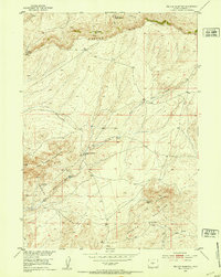
1952 · Tin Cup Mountain
USGS Topo · 1:24,000
1952 · Muskrat Basin
USGS Topo · 1:24,000
1952 · Rongis Reservoir SE
USGS Topo · 1:24,000
1952 · Rongis Reservoir
USGS Topo · 1:24,000
1953 · Blue Gulch
USGS Topo · 1:24,000
1953 · Elkhorn Springs
USGS Topo · 1:24,000

1955 · Lander
USGS Topo · 1:250,000