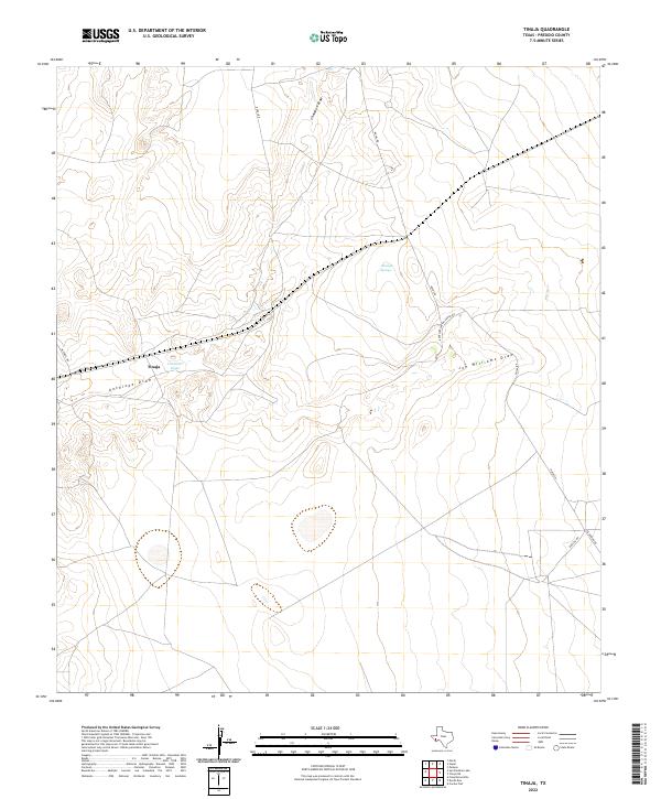
2022 Map of Tinaja
USGS Topo · Published 2022About this map
Tinaja anchors this high-desert landscape in Presidio County, where the topography is defined by an intricate network of seasonal drainage channels. The convergence of Chambers Draw and Antelope Draw at the central settlement highlights the critical importance of water geography in this arid region. This modern topographic survey illustrates how historical ranching corridors have evolved into the current road network, including Mitchell Rd and Nopal Rd. The presence of Antelope Springs and family-named landmarks like Joe Williams Draw provides a clear view of how land use and natural resources dictate the distribution of habitations in the Trans-Pecos. The sparse infrastructure, consisting largely of remote connectors like Escondido Rd and Barlite Rd, underscores the persistent isolation and rugged character of the West Texas interior.
Find a feature on this map
10 named features on this map. Tap any name to fly to it.
Don’t see what you’re looking for? This feature index may not catch every label — zoom into the map to look around manually.
Map Details
Editions of this 2022 Tinaja Map
This is the sole edition of this map. No revisions or reprints were ever made.
Other maps of this area

1895 · Marfa
USGS Topo · 1:125,000

1895 · Alpine
USGS Topo · 1:125,000

1954 · Fort Stockton
USGS Topo · 1:250,000

1958 · Fort Stockton
USGS Topo · 1:250,000

1959 · Marfa
USGS Topo · 1:250,000

1965 · Marfa
USGS Topo · 1:250,000

1972 · Paisano
USGS Topo · 1:24,000

1972 · Nopal
USGS Topo · 1:24,000

1973 · Fort Stockton
USGS Topo · 1:250,000
1983 · Cactus Flat
USGS Topo · 1:24,000