
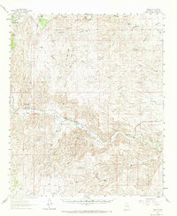
1961 Map of Tinnie
USGS Topo · Published 1964About this map
The Rio Hondo and Rio Ruidoso confluence defines the lower valley of this 1961 New Mexico survey, where irrigated life clings to the riverbank. Small communities like Tinnie, Picacho, and Sunset are connected by U.S. 70 380, marking the transition from the high canyons to the eastern ranchlands. The landscape is a network of family-held territories, from Wood Ranch in the north to McKnight Ranch in the south, illustrating the cattle-driven economy of Lincoln County during the mid-century era. Geographers and local historians can trace the intricate drainage systems of Escondido Canyon and Deadman Canyon, which feed into the central valley. Notable infrastructure includes a Gaging Sta on the Hondo and a designated Landing Area near Picacho, reflecting the logistical needs of a remote agricultural and ranching district. The presence of numerous named wells and tanks, such as Deadman Well and Coyote Tank, underscores the essential search for water in this high-desert terrain.
Find a feature on this map
55 named features on this map. Tap any name to fly to it.
Don’t see what you’re looking for? This feature index may not catch every label — zoom into the map to look around manually.
Map Details
Editions of this 1961 Tinnie Map
2 editions found
Other maps of this area

1935 · Capitan Mountains
USGS Topo · 1:48,000

1936 · Arabela
USGS Topo · 1:48,000

1940 · Capitan Mountains
USGS Topo · 1:62,500

1942 · Arabela
USGS Topo · 1:62,500

1955 · Roswell
USGS Topo · 1:250,000

1958 · Roswell
USGS Topo · 1:250,000

1961 · Flying H
USGS Topo · 1:62,500

1961 · Lincoln
USGS Topo · 1:62,500

1961 · Indian Bluff
USGS Topo · 1:62,500

1962 · Roswell
USGS Topo · 1:250,000