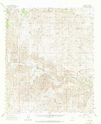
1961 Map of Tinnie
USGS Topo · Published 1971About this map
Rio Hondo cuts a vital path through this New Mexico landscape, providing a ribbon of water for the small agricultural settlements and family ranches that defined the region in the early 1960s. The survey captures the transition from high-elevation canyon systems like Deadman Canyon and Diablo Canyon to the more settled river valley. Along the course of the Rio Hondo, the map records the enduring presence of Tinnie, Picacho, and Riverside, each serving as a hub for the surrounding ranching community.
Find a feature on this map
34 named features on this map. Tap any name to fly to it.
Don’t see what you’re looking for? This feature index may not catch every label — zoom into the map to look around manually.
Map Details
Editions of this 1961 Tinnie Map
2 editions found
Other maps of this area

1935 · Capitan Mountains
USGS Topo · 1:48,000

1936 · Arabela
USGS Topo · 1:48,000

1940 · Capitan Mountains
USGS Topo · 1:62,500

1942 · Arabela
USGS Topo · 1:62,500

1955 · Roswell
USGS Topo · 1:250,000

1958 · Roswell
USGS Topo · 1:250,000

1961 · Flying H
USGS Topo · 1:62,500

1961 · Lincoln
USGS Topo · 1:62,500

1961 · Indian Bluff
USGS Topo · 1:62,500

1961 · Tinnie
USGS Topo · 1:62,500