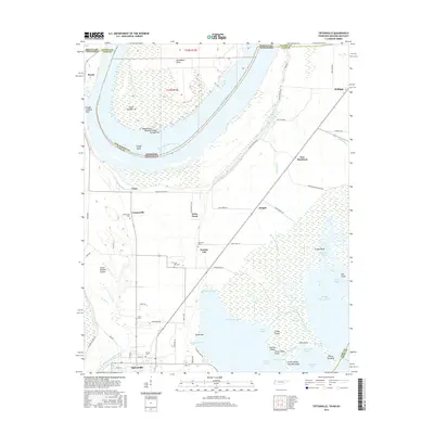
2016 Map of Tiptonville
USGS Topo · Published 2016About this map
Tiptonville sits at the southern edge of this West Tennessee landscape, where the shifting waters of the Mississippi River have carved a complex geography of bends, sloughs, and basins. The map illustrates the profound impact of the river's historical course, particularly around Island Number 10 and the prominent Slough Landing Neck. These hydrological features are flanked by small agricultural settlements such as Cronanville, Phillippy, and Proctor City, connected by a network of local roads including Cates Landing Rd N and Levee Rd.
Find a feature on this map
80 named features on this map. Tap any name to fly to it.
Don’t see what you’re looking for? This feature index may not catch every label — zoom into the map to look around manually.
Map Details
Editions of this 2016 Tiptonville Map
This is the sole edition of this map. No revisions or reprints were ever made.
Other maps of this area

1925 · Reelfoot Lake
USGS Topo · 1:62,500

1939 · Reelfoot Lake
USGS Topo · 1:62,500

1939 · Portageville
USGS Topo · 1:62,500

1939 · New Madrid
USGS Topo · 1:62,500

1939 · Bayouville
USGS Topo · 1:62,500

1951 · Bondurant
USGS Topo · 1:24,000

1951 · New Madrid SE
USGS Topo · 1:24,000

1951 · Hubbard Lake
USGS Topo · 1:24,000

1954 · New Madrid
USGS Topo · 1:62,500

1955 · Portageville
USGS Topo · 1:62,500