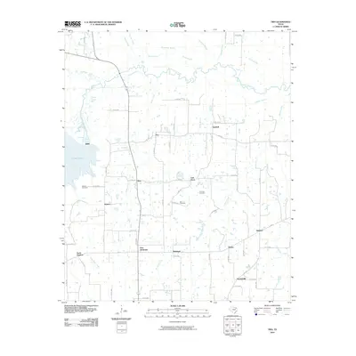
2010 Map of Tira
USGS Topo · Published 2010About this map
Tira and the neighboring rural communities of Birthright and New Birthright anchor this landscape in northern Hopkins County. The terrain is defined by the winding course of the South Sulphur River and the eastern reaches of Cooper Lake, which dominate the western edge of the quadrangle. Numerous small watercourses, including Morgan Creek and Wolf Creek, drain the surrounding farmland, creating a dense network of creeks and branches that historically shaped local agriculture and land use.
Find a feature on this map
68 named features on this map. Tap any name to fly to it.
Don’t see what you’re looking for? This feature index may not catch every label — zoom into the map to look around manually.
Map Details
Editions of this 2010 Tira Map
This is the sole edition of this map. No revisions or reprints were ever made.
Other maps of this area

1953 · Texarkana
USGS Topo · 1:250,000

1956 · Texarkana
USGS Topo · 1:250,000

1962 · Sulphur Bluff
USGS Topo · 1:24,000

1963 · Minter
USGS Topo · 1:24,000

1964 · Sulphur Springs
USGS Topo · 1:24,000

1964 · Gafford Chapel
USGS Topo · 1:24,000

1964 · Charleston
USGS Topo · 1:24,000

1964 · Tira
USGS Topo · 1:24,000

1964 · Cooper North
USGS Topo · 1:24,000
1964 · Cooper South
USGS Topo · 1:24,000