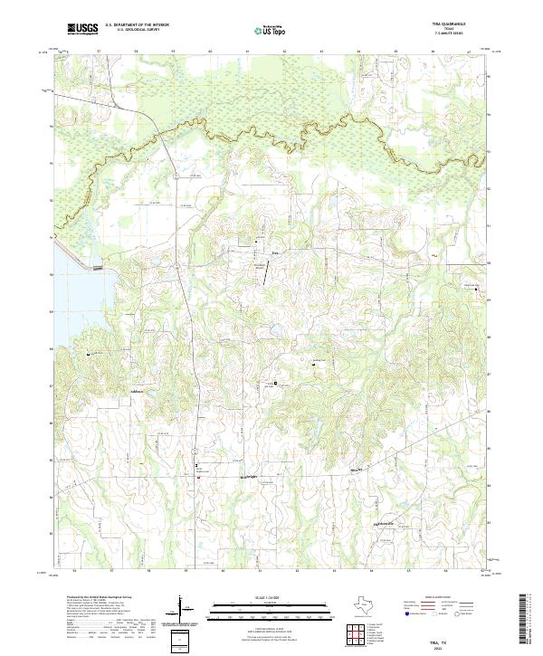
2022 Map of Tira
USGS Topo · Published 2022About this map
The South Sulphur River meanders across the northern portion of this Hopkins County landscape, defining the winding boundary with Delta County. This area of East Texas is characterized by its rural settlement pattern, where small communities like Tira, Birthright, Addran, and Shirley are connected by a network of farm-to-market roads and county lanes. The geography is defined by numerous creek branches, including Vaden Cr, Wolf Cr, and Morgan Cr, which drain the low-lying terrain south toward the river basin.
Find a feature on this map
74 named features on this map. Tap any name to fly to it.
Don’t see what you’re looking for? This feature index may not catch every label — zoom into the map to look around manually.
Map Details
Editions of this 2022 Tira Map
This is the sole edition of this map. No revisions or reprints were ever made.
Other maps of this area

1953 · Texarkana
USGS Topo · 1:250,000

1956 · Texarkana
USGS Topo · 1:250,000

1962 · Sulphur Bluff
USGS Topo · 1:24,000

1963 · Minter
USGS Topo · 1:24,000

1964 · Sulphur Springs
USGS Topo · 1:24,000

1964 · Gafford Chapel
USGS Topo · 1:24,000

1964 · Charleston
USGS Topo · 1:24,000

1964 · Tira
USGS Topo · 1:24,000

1964 · Cooper North
USGS Topo · 1:24,000
1964 · Cooper South
USGS Topo · 1:24,000