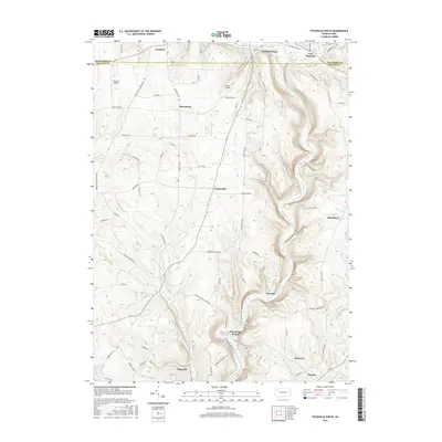
2016 Map of Titusville South
USGS Topo · Published 2016About this map
Petroleum Center and Pioneer sit along the winding banks of Oil Creek, marking a landscape deeply tied to Pennsylvania's early industrial identity. The terrain in this southern portion of the Titusville area is defined by sharp elevation changes, where tributaries like Cherrytree Run and Husband Run carve through the hills. Small rural clusters and historical settlements such as Gresham, Breedtown, and Kaneville are connected by a network of winding roads like Old Petroleum Center Rd and Hamilton Corners Rd. Aviation history is present through both the Titusville Airport and Shriver Airport, while the proximity to the Crawford Co and Venango Co line highlights the regional importance of this valley. The map reveals a mix of dense forest cover and cleared land, typical of a region shaped by both the timber and petroleum eras.
Find a feature on this map
60 named features on this map. Tap any name to fly to it.
Don’t see what you’re looking for? This feature index may not catch every label — zoom into the map to look around manually.
Map Details
Editions of this 2016 Titusville South Map
This is the sole edition of this map. No revisions or reprints were ever made.
Other maps of this area

1909 · Franklin
USGS Topo · 1:62,500

1911 · Franklin
USGS Topo · 1:62,500

1922 · Oil City
USGS Topo · 1:48,000

1924 · Oil City
USGS Topo · 1:62,500

1927 · Townville
USGS Topo · 1:48,000

1927 · Titusville
USGS Topo · 1:62,500

1932 · Townville
USGS Topo · 1:62,500

1933 · Titusville
USGS Topo · 1:62,500

1943 · Oil City
USGS Topo · 1:62,500

1945 · Townville
USGS Topo · 1:62,500
Featured Places
- Titusville, PA
- Cherrytree Township, PA
- Troy Township, PA
- Shamburg, Oil Creek Township
- Kaneville, Cornplanter Township