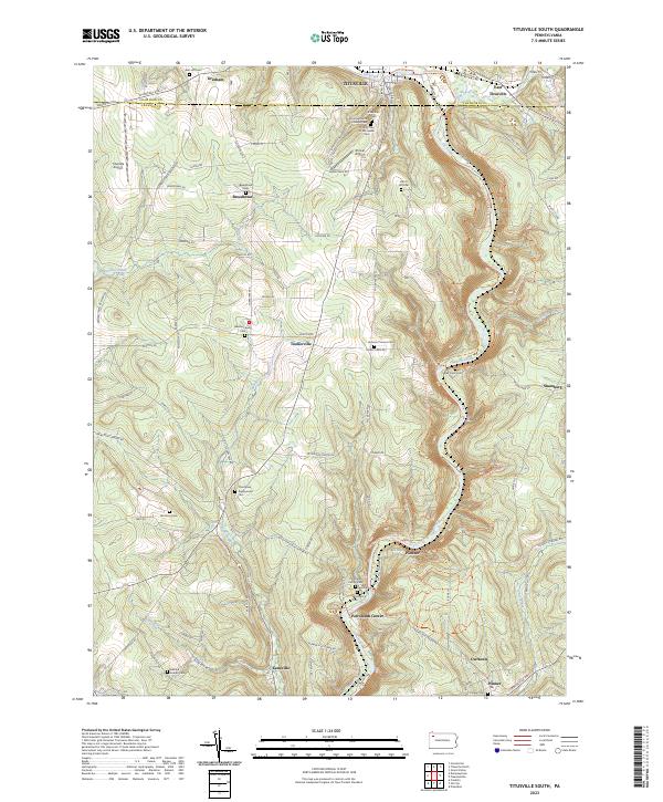
2023 Map of Titusville South
USGS Topo · Published 2023About this map
Petroleum Center and the winding valley of Oil Creek dominate this landscape south of Titusville, marking the heart of Pennsylvania's historic oil region. The map reveals a dense concentration of cultural and genealogical markers, particularly along the ridges and creek bottoms. Several distinct cemeteries, including B'nai Zion Cem, B'nai Gemiluth Chesed Cem, and the Oil City Tree of Life Jewish Cem, reflect the diverse immigrant communities that settled here during the industrial boom. Smaller family and community sites like Buxton Family Cem and Oakland Seceder Cem are tucked away near settlements like Breedtown and Kaneville. The terrain is deeply incised by waterways such as Cherrytree Run and Pine Creek, which historically dictated the paths of roads and the placement of early drilling operations. Local aviation history is also noted with the presence of Shriver Airport and Titusville Airport on the upland plateaus.
Find a feature on this map
92 named features on this map. Tap any name to fly to it.
Don’t see what you’re looking for? This feature index may not catch every label — zoom into the map to look around manually.
Map Details
Editions of this 2023 Titusville South Map
This is the sole edition of this map. No revisions or reprints were ever made.
Other maps of this area

1909 · Franklin
USGS Topo · 1:62,500

1911 · Franklin
USGS Topo · 1:62,500

1922 · Oil City
USGS Topo · 1:48,000

1924 · Oil City
USGS Topo · 1:62,500

1927 · Townville
USGS Topo · 1:48,000

1927 · Titusville
USGS Topo · 1:62,500

1932 · Townville
USGS Topo · 1:62,500

1933 · Titusville
USGS Topo · 1:62,500

1943 · Oil City
USGS Topo · 1:62,500

1945 · Townville
USGS Topo · 1:62,500