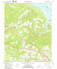
1965 Map of Toano
USGS Topo · Published 1979About this map
Toano and the neighboring community of Norge serve as central nodes along the Chesapeake and Ohio Railroad in this detailed survey of James City and New Kent Counties. The landscape is defined by an intricate network of wetlands, including Richardson Swamp and Wahrani Swamp, which feed into the York River. A notable engineering feature is the Diascund Creek Reservoir, with its specified spillway elevation, indicating the area's mid-century water management. Local social infrastructure is well-represented through numerous country churches such as Hickory Neck Ch and Tabernacle Ch, alongside the State Prison Camp No 16 near the northern boundary. The presence of Richardson Millpond and several family-named ponds and swamps highlights a rural economy historically tied to the region's abundant water resources and timberlands.
Find a feature on this map
47 named features on this map. Tap any name to fly to it.
Don’t see what you’re looking for? This feature index may not catch every label — zoom into the map to look around manually.
Map Details
Editions of this 1965 Toano Map
4 editions found
Other maps of this area

1906 · Williamsburg
USGS Topo · 1:62,500

1917 · Urbanna
USGS Topo · 1:62,500

1917 · Toano
USGS Topo · 1:62,500

1918 · Toano
USGS Topo · 1:62,500

1919 · New Kent
USGS Topo · 1:62,500

1943 · Richmond
USGS Topo · 1:250,000

1949 · Shacklefords
USGS Topo · 1:24,000

1949 · New Kent
USGS Topo · 1:24,000

1949 · Richmond
USGS Topo · 1:250,000

1950 · West Point
USGS Topo · 1:24,000