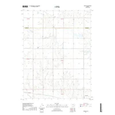
2017 Map of Tobias SW
USGS Topo · Published 2017About this map
Alexandria anchors the southeastern corner of this rural Thayer County landscape, where the local economy and geography are defined by the winding paths of the Sandy Creek system. The map documents a classic agricultural grid of section lines and gravel roads, such as Rd X and Road W, interspersed with essential community landmarks that serve the surrounding farmsteads. Genealogists will find significant value in the documentation of local burial grounds, including Franklin Cem to the north and Pleasant Plain Cem near the center of the quadrangle. The hydrology of the region is punctuated by man-made water features like Sieber Reservoir and Kerwood Reservoir, which alongside Big Sandy Cr, provide the primary relief in an otherwise disciplined prairie landscape.
Find a feature on this map
24 named features on this map. Tap any name to fly to it.
Don’t see what you’re looking for? This feature index may not catch every label — zoom into the map to look around manually.
Map Details
Editions of this 2017 Tobias SW Map
This is the sole edition of this map. No revisions or reprints were ever made.
Other maps of this area

1898 · Hebron
USGS Topo · 1:125,000

1955 · Lincoln
USGS Topo · 1:250,000

1957 · Lincoln
USGS Topo · 1:250,000

1958 · Lincoln
USGS Topo · 1:250,000

1960 · Bruning
USGS Topo · 1:24,000

1960 · Tobias SW
USGS Topo · 1:24,000

1960 · Alexandria
USGS Topo · 1:24,000
1960 · Gladstone
USGS Topo · 1:24,000

1960 · Daykin
USGS Topo · 1:24,000
1960 · Hebron
USGS Topo · 1:24,000