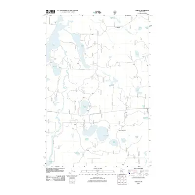
2011 Map of Tobique
USGS Topo · Published 2011About this map
The settlement of Tobique serves as the central point for this northern Minnesota landscape, where a complex network of waterways defines the local geography. The winding Boy River and Swift River connect numerous water bodies, including the expansive Boy Lake and the smaller Tobique Lake to the north. These interconnected lakes and rivers illustrate a classic glacial terrain that has long supported local recreation and timber interests.
Find a feature on this map
35 named features on this map. Tap any name to fly to it.
Don’t see what you’re looking for? This feature index may not catch every label — zoom into the map to look around manually.
Map Details
Editions of this 2011 Tobique Map
This is the sole edition of this map. No revisions or reprints were ever made.
Other maps of this area

1953 · Duluth
USGS Topo · 1:250,000

1953 · Brainerd
USGS Topo · 1:250,000

1954 · Bemidji
USGS Topo · 1:250,000

1954 · Hibbing
USGS Topo · 1:250,000

1957 · Brainerd
USGS Topo · 1:250,000

1957 · Bemidji
USGS Topo · 1:250,000

1957 · Hibbing
USGS Topo · 1:250,000

1958 · Bemidji
USGS Topo · 1:250,000

1958 · Hibbing
USGS Topo · 1:250,000
1958 · Brainerd
USGS Topo · 1:250,000