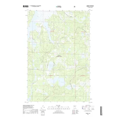
2019 Map of Tobique
USGS Topo · Published 2019About this map
Chippewa National Forest encompasses the vast majority of this landscape, where the small settlement of Tobique sits near the northeastern shore of Tobique Lake. The area is defined by an intricate network of water and wetlands, with the Boy River and Swift River meandering between numerous basins including Boy Lake, Portage Lake, and the distinctive Twin Lakes. This 2019 survey documents a region dedicated to modern recreation and conservation, showing the paths of the N Country National Scenic Trail and the Sod Line Gia Snowmobile Trail as they navigate the dense woodlands. Local history is subtly noted through landmarks like Indian Cemetery Rd and names like Mabel Lake and Phelon Lake, offering a detailed look at the contemporary state of these northern Minnesota woods and waters.
Find a feature on this map
39 named features on this map. Tap any name to fly to it.
Don’t see what you’re looking for? This feature index may not catch every label — zoom into the map to look around manually.
Map Details
Editions of this 2019 Tobique Map
This is the sole edition of this map. No revisions or reprints were ever made.
Other maps of this area

1953 · Duluth
USGS Topo · 1:250,000

1953 · Brainerd
USGS Topo · 1:250,000

1954 · Bemidji
USGS Topo · 1:250,000

1954 · Hibbing
USGS Topo · 1:250,000

1957 · Brainerd
USGS Topo · 1:250,000

1957 · Bemidji
USGS Topo · 1:250,000

1957 · Hibbing
USGS Topo · 1:250,000

1958 · Bemidji
USGS Topo · 1:250,000

1958 · Hibbing
USGS Topo · 1:250,000
1958 · Brainerd
USGS Topo · 1:250,000