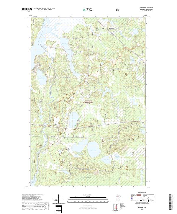
2022 Map of Tobique
USGS Topo · Published 2022About this map
Chippewa National Forest dominates this landscape in Cass County, where a complex network of glacial lakes and waterways defines the local geography. The small settlement of Tobique sits in the northern reaches, positioned near the shores of Tobique Lake and the winding Swift River. This area serves as a significant recreational crossroads, featuring the North Country National Scenic Trl and the Boy River Canoe Route Trl which navigate through the dense woods and wetlands. Historical and cultural markers are present in names like Indian Cemetery Rd near Boy Lake, suggesting long-standing ties to the land. The map details numerous water bodies of varying sizes, from the larger Inguadona Lake at the southern border to smaller, evocative features like Lost Girl Lake and Mabel Lake, illustrating the post-glacial topography characteristic of northern Minnesota.
Find a feature on this map
42 named features on this map. Tap any name to fly to it.
Don’t see what you’re looking for? This feature index may not catch every label — zoom into the map to look around manually.
Map Details
Editions of this 2022 Tobique Map
This is the sole edition of this map. No revisions or reprints were ever made.
Other maps of this area

1953 · Duluth
USGS Topo · 1:250,000

1953 · Brainerd
USGS Topo · 1:250,000

1954 · Bemidji
USGS Topo · 1:250,000

1954 · Hibbing
USGS Topo · 1:250,000

1957 · Brainerd
USGS Topo · 1:250,000

1957 · Bemidji
USGS Topo · 1:250,000

1957 · Hibbing
USGS Topo · 1:250,000

1958 · Bemidji
USGS Topo · 1:250,000

1958 · Hibbing
USGS Topo · 1:250,000

1958 · Brainerd
USGS Topo · 1:250,000